Case study · US
Katrina and Sandy
New Orleans · New York Bight
Two North Atlantic cyclones, two different coasts, one shared physics: low pressure, wind, surge, and a shoreline that was already under stress.
Locator · OpenStreetMap / OpenFreeMap · 29.95°, -90.07°
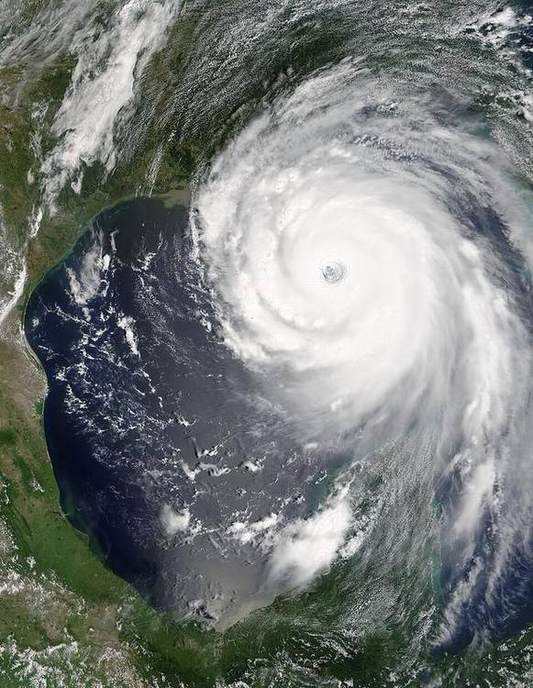
Hurricane Katrina (2005) hit the Gulf Coast as a large tropical cyclone. The catastrophe in New Orleans was a surge and a levée-and-floodwall failure on a city below some water surfaces, on a sinking delta. The eye and eyewall of a tropical cyclone are the lab; the social and engineering failure is the case. Keep them both in the script, and do not invent fatality numbers — cite NOAA.
Hurricane Sandy (2012) was a late-season hybrid that struck the New York–New Jersey Bight. Storm surge in a funnel-shaped coast, high tide, and a dense urban shoreline. It was not ‘just rain’. Surge is a water-level story; rainfall is a hydrograph story. Students mix them.
The tropical-cyclone lab shows the eye, eyewall, and rainbands. It does not claim that every UK windy day is a hurricane. Midlatitude cyclones are a different machine (the fronts lab). Sandy’s hybrid nature is a teacher’s caution, not a KS3 requirement.
UK pair: North Sea storm surges (1953, and the Thames Barrier’s reason for existing). Same surge idea, extra-tropical storms. Honest language: do not call a UK winter storm a hurricane unless the Met Office does.
Exam-style question
Distinguish storm surge from river flooding in the Katrina disaster, and say which lab models the cyclone itself.
Teacher hint: Surge: sea level driven by wind and pressure. River/levée: inland water. Lab: tropical cyclone eye/eyewall.
Process labs
Sources
- NOAA / NHC Katrina and Sandy reports
- USGS surge and high-water marks