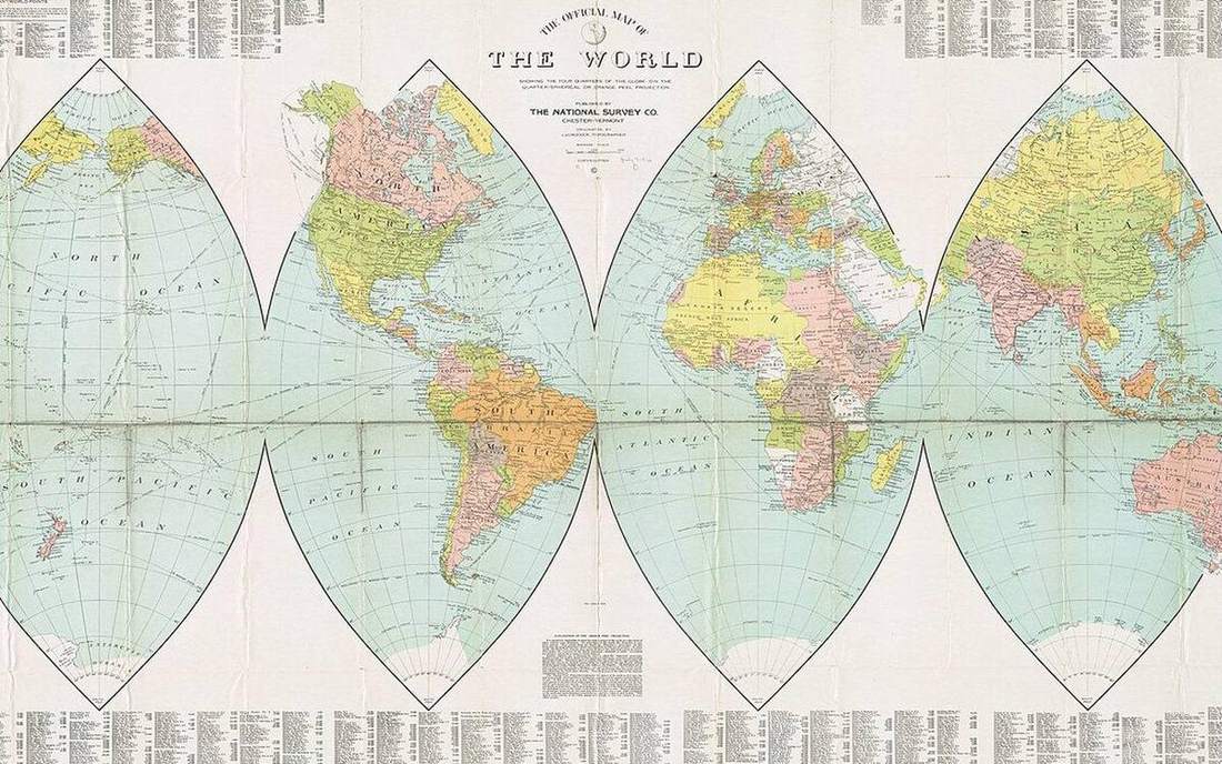
 A projection as a peeled sphere. This is the classroom sense of map-projections: a named landform, process, or object. Source: Wikimedia Commons / NASA / USGS / NOAA, public domain or CC.Wikimedia Commons / NASA / USGS / NOAA, public domain or CC
Why this matters
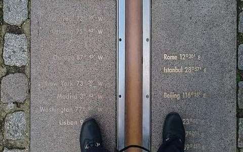
A classroom wall map is a projection, not the true size of countries. News maps that grow Russia and shrink Africa are a choice about area, not a verdict on people. Start with area. Greenland is the giveaway: on Mercator it looks about the size of Africa; on the globe it is far smaller. Iceland sits at high latitude, so it balloons on the same family of maps. Greenwich is a meridian, not a map — the plaque does not flatten the Earth. An OS sheet of Snowdonia and a USGS quad of Yosemite are local projections with different jobs; they are not a moral statement about the world. Atlas versus this site’s tools/map: both flatten; this lab says how, and what you lose when you peel the orange.
 Field photograph or official scientific figure for teaching map projections. A second photograph for the projector script — not the lab cover. Source: Wikimedia Commons / NASA / USGS / NOAA, public domain or CC.Wikimedia Commons / NASA / USGS / NOAA, public domain or CC
The mechanism
Do not start a culture war. Start with area. A sphere does not flatten without tears. Peel an orange: the skin rips. Every world map chooses what to keep and what to distort. Mercator keeps local shape — it is conformal — and makes rhumb lines, paths of constant bearing, straight, which is why it was used at sea. High latitudes balloon, so Greenland and Iceland swell while Africa looks small. Africa is about fourteen times the area of Greenland. Mercator hides that. An equal-area projection keeps relative sizes of regions; shapes then take the hit. A compromise is neither perfect. The globe in this lab is the reference: a sphere almost does not need a projection. Projections start when you flatten. Orange-peel gores show the tears at the cuts. Local OS maps and USGS quads are a different problem — a projected grid on a small patch, not a world poster. There is no honest single map of the whole Earth. Choose the lie you can live with. Do not teach one projection as morally pure. Area first, then shape, then the navigation story.
How to drive the model
Start on the globe. Ask Greenland versus Africa. Greenland is smaller than Africa. Scrub Flatten toward the orange-peel gores: the skin tears at the cuts. Then Mercator: high latitudes balloon. Ask what happened to Greenland’s area before you name the projection. Leave labels off until the class can say which view is the globe. Do not start a culture war at the slider. Start with area, then rhumb lines as the navigation reason Mercator survived. Keyboard: L labels, R reset. Flatten slider lives in the control bar. The readout names globe, gores, then Mercator-like flatten. Compare sizes before names.
If the model will not spin
The land outlines are teaching silhouettes, not a traced census of coastlines. Greenland and Africa are sized so the area lie reads from the back row. Gores are schematic strips, not a printer’s template. Mercator here is Mercator-like: enough stretch to see the balloon, not a navigation chart. Local OS and USGS sheets are off-stage; they flatten a county, not a planet. Without the 3D view: a globe needs no projection; flattening tears; Mercator inflates high latitudes; equal-area keeps size and spends shape; there is no honest single world map. Start with area, not with a quarrel.
Film
What is a Map? Crash Course Geography #2. Crash Course Geography. About 11 min. Crash Course / Complexly on YouTube. Standard YouTube licence. Educational embed, autoplay off. Autoplay off.
Misconceptions
The classroom wall map is the true size of countries.
It is a projection. Compare Greenland and Africa on the globe first.
Mercator is a political lie designed to make the north look powerful.
Mercator was built for rhumb-line navigation. High latitudes balloon as a geometric cost. Start with area, not with a culture war.
There is one honest map of the whole Earth.
Every world map is a compromise. Equal-area keeps size and spends shape. The globe is the reference; local OS maps are a different problem.
Projection
A rule for flattening the globe onto a plane. Every rule distorts something.
 Projection in the map-projections lab — a TERMS crop, not the glossary plate and not the lab cover. A rule for flattening the globe onto a plane. Source: Wikimedia Commons / NASA / USGS / public domain.Wikimedia Commons / NASA / USGS / public domain
Mercator
Conformal cylindrical. Rhumb lines straight. Distorts area toward the poles.
 mercator in the map-projections lab — a TERMS crop, not the glossary plate and not the lab cover. A TERMS crop, not the glossary plate and not the lab cover. Source: Wikimedia Commons / NASA / USGS / NOAA, public domain or CC.Wikimedia Commons / NASA / USGS / NOAA, public domain or CC
Equal-area
Preserves relative area of regions. Distorts shape.
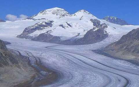 equal area in the map-projections lab — a TERMS crop, not the glossary plate and not the lab cover. A TERMS crop, not the glossary plate and not the lab cover. Source: Wikimedia Commons / NASA / USGS / NOAA, public domain or CC.Wikimedia Commons / NASA / USGS / NOAA, public domain or CC
Conformal
Preserves local shape and angles. Area then takes the hit.
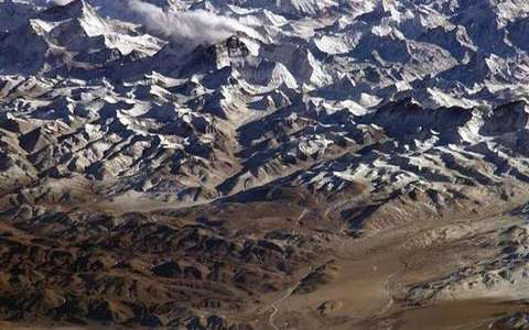 conformal in the map-projections lab — a TERMS crop, not the glossary plate and not the lab cover. A TERMS crop, not the glossary plate and not the lab cover. Source: Wikimedia Commons / NASA / USGS / NOAA, public domain or CC.Wikimedia Commons / NASA / USGS / NOAA, public domain or CC
Rhumb line
A path of constant bearing. Straight on Mercator; not the shortest route.
 rhumb line in the map-projections lab — a TERMS crop, not the glossary plate and not the lab cover. A TERMS crop, not the glossary plate and not the lab cover. Source: Wikimedia Commons / NASA / USGS / NOAA, public domain or CC.Wikimedia Commons / NASA / USGS / NOAA, public domain or CC
Gores
Orange-peel strips of the globe. The tears at the cuts are the cost of flattening.
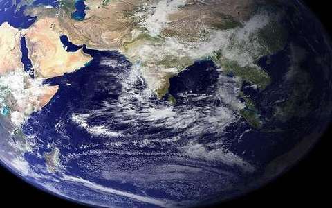 gores in the map-projections lab — a TERMS crop, not the glossary plate and not the lab cover. A TERMS crop, not the glossary plate and not the lab cover. Source: Wikimedia Commons / NASA / USGS / NOAA, public domain or CC.Wikimedia Commons / NASA / USGS / NOAA, public domain or CC
Compromise projection
A map that splits the distortion so nothing is perfect and nothing is ruinous.
 compromise projection in the map-projections lab — a TERMS crop, not the glossary plate and not the lab cover. A TERMS crop, not the glossary plate and not the lab cover. Source: Wikimedia Commons / NASA / USGS / NOAA, public domain or CC.Wikimedia Commons / NASA / USGS / NOAA, public domain or CC
Distortion
What a projection spends: area, shape, distance, or direction. You cannot keep all four on a world map.
 distortion in the map-projections lab — a TERMS crop, not the glossary plate and not the lab cover. A TERMS crop, not the glossary plate and not the lab cover. Source: Wikimedia Commons / NASA / USGS / NOAA, public domain or CC.Wikimedia Commons / NASA / USGS / NOAA, public domain or CC