Case study · UK
Jurassic Coast
Dorset and East Devon
A World Heritage rock sequence, and a coastline that writes cave–arch–stack–stump in Lias and chalk.
Locator · OpenStreetMap / OpenFreeMap · 50.62°, -2.25°
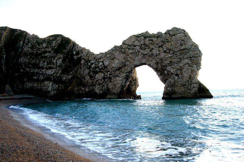
The Jurassic Coast is a teaching gift because lithology changes along the shore. Harder bands stand as headlands; weaker bands cut back as bays. Concordant and discordant patterns both appear. Durdle Door is an arch in limestone. Old Harry Rocks are chalk stacks off the Foreland. Lulworth Cove is a bay cut through a hard band into softer Wealden clays behind.
The cave–arch–stack–stump sequence needs a headland, joints or bedding the sea can exploit, and enough energy to keep working the same lines. Hydraulic action, abrasion, and attrition do the cutting. Weathering opens the joints from above. When the arch roof fails, a stack stands. When the stack fails, a stump sits in the surf. The lab animates that sequence; this coast is where UK students are taken to see it in rock.
Landslides at Black Ven and Stonebarrow remind a class that coasts are not only waves. Rain, groundwater, and a clay layer can send a whole undercliff toward the beach. The 2012 landslip near Bridport closed the coast path. Process on a cliff is always two-sided: marine at the toe, sub-aerial on the face.
Tourism, fossil collecting, and shoreline management sit on top of the geology. Students should not be asked to memorise every cove. They should be able to match a named landform to a process and a rock type, then say what happens if the energy or the lithology changes.
Exam-style question
Using a named Jurassic Coast landform, describe the sequence from cave to stump.
Teacher hint: Joints → cave → arch (Durdle Door) → collapse → stack (Old Harry) → stump.
Process labs
Sources
- Jurassic Coast Trust / UNESCO
- BGS — Dorset coast