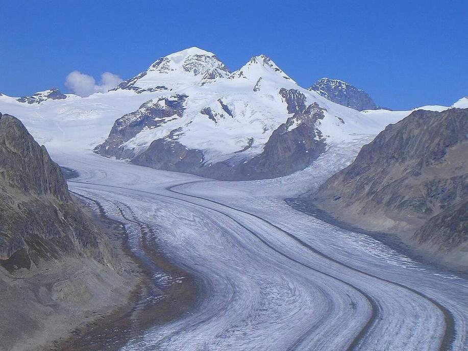
 Ice as a tool.Wikimedia Commons, CC BY
Why this matters
Ice is a river that can be a kilometre thick. It leaves a cirque, an arête, a horn, a U, and a pile of till. The Lake District and Snowdonia are the UK pair: Helvellyn’s Red Tarn, Striding Edge, Crib Goch, cwms eating a ridge. Yosemite is the US pair: a deeper U in granite, hanging valleys, Half Dome, moraines down-valley. Same ice logic, different rock and a different poster. GCSE AQA 3.1.3.3 and NGSS MS-ESS2-2 both need U versus V, and the honesty that Yosemite is not a river canyon like the Grand Canyon. Glaciers exist where snow survives the year — latitude and altitude — not only at the poles. A UK upland trough with a beck in the floor is ice first, water second.
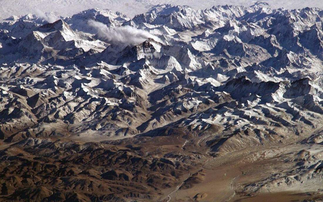 Field photograph or official scientific figure for teaching glaciers. A second photograph for the projector script — not the lab cover. Source: Wikimedia Commons / NASA / USGS / NOAA, public domain or CC.Wikimedia Commons / NASA / USGS / NOAA, public domain or CC
The mechanism
A cirque (cwm, corrie) is an armchair hollow with a steep backwall. Two cirques eating a ridge leave an arête, a knife. Three or more eating a peak leave a horn, a pyramidal peak. Ice overdeepens a wide floor: a U-trough, truncated spurs, hanging valleys that dump waterfalls. Till is dumped as moraines — lateral, medial, terminal — at the ice margin. A drumlin is a streamlined till hill. Play advance: the tongue thickens and the U deepens. Play retreat: the snout dumps the pile. Ice versus water is U versus V. Yosemite is ice in granite; the Grand Canyon is a river in a plateau; do not swap the names. Vertical exaggeration is labelled ×6. Ice has thickness; it is not a white sticker on a hill. The tongue is a classroom glacier, not a traced ice stream. Lake District ice is mostly gone; the landforms remain. Yosemite’s glaciers are remnants; the valley is the scar. Glaciers are not only polar. They exist where snow survives the year. Abrasion and plucking do the cutting; freeze–thaw helps the backwall. A hanging valley is a tributary trough left high when the trunk ice overdeepened. That is why Yosemite Falls start in mid-air.
How to drive the model
Labels off. Name cirque, arête, horn before you reveal. Cirque is the armchair. Arête is the knife between two cirques. Horn is three or more eating a peak. Advance the ice; the U-trough deepens. Retreat to the snout; moraines dump till. Keyboard: space, arrows, L labels, R reset. Vertical exaggeration is ×6; ice is thick, not a sticker. Till is the pile. The landform names are the scar. Finish in Check. Yosemite is not a river canyon like the Grand Canyon. Lake District and Yosemite are the pair.
If the model will not spin
Without the 3D view: ice is a thick river. Cirque armchair, arête knife, horn peak, U-trough, moraine pile. Ice versus water is U versus V. Lake District and Yosemite are the pair. Snowdonia’s Crib Goch is an arête you remember with your hands. Glaciers exist where snow survives the year, not only at the poles. Vertical exaggeration is ×6 and labelled. Ice has thickness. Do not call Yosemite a river canyon like the Grand Canyon. Till is the pile; the names are the scar.
Film
What Are Glaciers? Crash Course Geography #23. Crash Course Geography. About 11 min. Crash Course / Complexly on YouTube. Standard YouTube licence. Educational embed, autoplay off. Autoplay off.
Misconceptions
Glaciers only exist at the poles.
They exist where snow survives the year. Latitude and altitude.
Yosemite is a river canyon like the Grand Canyon.
Yosemite is ice in granite — a U. Grand Canyon is a river in a plateau. Cross-profile tells them apart.
Ice is a white sticker on a hill.
Ice is a thick river. It has thickness. Vertical exaggeration here is ×6 and labelled.
Cirque
Armchair hollow with a steep backwall.
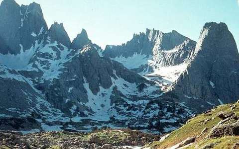 Cirque in the glaciers lab — a TERMS crop, not the glossary plate and not the lab cover. Armchair hollow with a steep backwall. Source: Wikimedia Commons / NASA / USGS / public domain.Wikimedia Commons / NASA / USGS / public domain
Arête
Knife ridge between cirques.
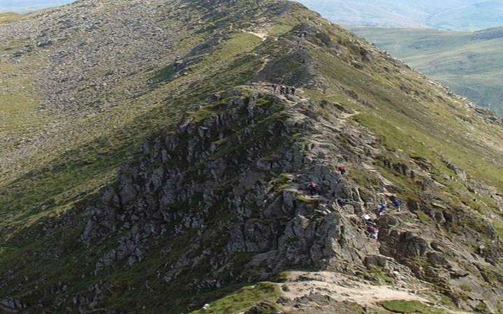 Arête: a matching field photograph or official scientific figure. An arête is a knife-edged ridge left where two cirques cut back-to-back. Source: Wikimedia Commons / NASA / USGS / public domain.Wikimedia Commons / NASA / USGS / public domain
Horn
Pyramidal peak eaten by three or more cirques.
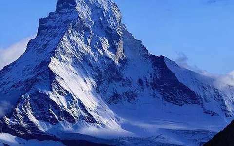 Horn in the glaciers lab — a TERMS crop, not the glossary plate and not the lab cover. Pyramidal peak eaten by three or more cirques. Source: Wikimedia Commons / NASA / USGS / public domain.Wikimedia Commons / NASA / USGS / public domain
U-trough
Wide floor and steep walls overdeepened by ice.
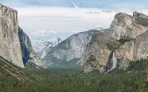 U-trough in the glaciers lab — a TERMS crop, not the glossary plate and not the lab cover. Wide floor and steep walls overdeepened by ice. Source: Wikimedia Commons / NASA / USGS / public domain.Wikimedia Commons / NASA / USGS / public domain
Moraine
Till ridge dumped by ice at the margin.
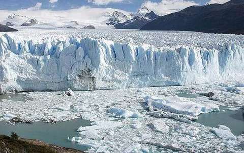 Moraine in the glaciers lab — a TERMS crop, not the glossary plate and not the lab cover. Till ridge dumped by ice at the margin. Source: Wikimedia Commons / NASA / USGS / public domain.Wikimedia Commons / NASA / USGS / public domain
Till
Unsorted debris dropped by ice. The pile.
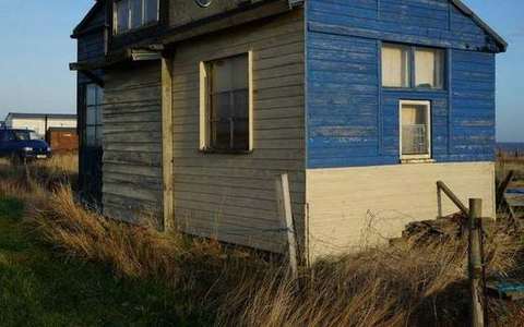 Till in the glaciers lab — a TERMS crop, not the glossary plate and not the lab cover. Unsorted debris dropped by ice. Source: Wikimedia Commons / NASA / USGS / public domain.Wikimedia Commons / NASA / USGS / public domain
Hanging valley
A tributary trough left high when the trunk ice overdeepened.
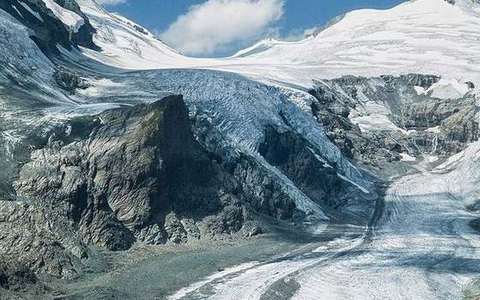 Hanging valley in the glaciers lab — a TERMS crop, not the glossary plate and not the lab cover. A tributary trough left high when the trunk ice overdeepened. Source: Wikimedia Commons / NASA / USGS / public domain.Wikimedia Commons / NASA / USGS / public domain
Drumlin
Streamlined till hill, blunt up-ice, tapered down-ice.
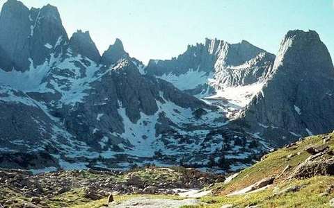 Drumlin in the glaciers lab — a TERMS crop, not the glossary plate and not the lab cover. Streamlined till hill, blunt up-ice, tapered down-ice. Source: Wikimedia Commons / NASA / USGS / public domain.Wikimedia Commons / NASA / USGS / public domain