 Age increases away from the axis.NOAA / USGS, public domain
Why this matters
Iceland is the ridge with a country on it, which is why every UK specification parks a case study there. New crust at the axis, older as you walk toward Europe or North America, centimetres per year. Magnetic stripes are the tape recorder: geomagnetic reversals frozen in cooling basalt, mirrored on both flanks. The United States pair is not a second Iceland. Cascadia consumes old Pacific crust at a trench; San Andreas is a transform that does not make ocean floor. Together they complete the conveyor: born at Iceland’s ridge, aged across the basin, destroyed or slid at the far edge. If ocean floor were all the same age, those stripes would not exist and Iceland would be a mystery island. A class that treats the Atlantic as primordial water has not met Vine–Matthews. Kola’s borehole never reached this story; this is surface basalt writing time, not a 12 km scratch in continental crust. UK and US maps both freeze today’s ocean as if it had always been there. It has not.
 A second photograph for the projector script — not the lab cover.Wikimedia Commons / NASA / USGS
The mechanism
At a mid-ocean ridge, plates diverge. Magma fills the gap; new oceanic crust records the field as it cools through the Curie point. Newest crust sits at the ridge axis. Stripes are symmetric because both sides add crust. Vine–Matthews: reversals frozen in basalt, a tape recorder of time. Spreading rate is how fast plates separate, typically centimetres per year, not a weather story. Iceland sits on the Mid-Atlantic Ridge, plume-boosted, which is why there is land. Old crust is not immortal: it ages away and is swallowed at trenches such as Cascadia. San Andreas is a different boundary — transform, no stripe factory. The Himalaya stack continent on continent; they do not print this tape. The model’s labelled lie is printed on the studio: vertical exaggeration ×12. The ridge is a mountain under the sea, but this height field is a classroom cliff. Stripes are colour bands, not a magnetometer record. Spreading that fills a lesson is millions of years of centimetres per year. Transform offsets on the ridge are a sine wobble, not a fracture-zone chart. What remains true: young at the axis, old away, mirrored polarity, Iceland on the ridge. Ocean floor is not all the same age.
How to drive the model
There is no extra slider on this lab. Find the ridge axis — newest crust sits there. Press Space: new stripes walk away, mirrored. Left and right arrows nudge the same tape. L toggles labels. R resets. P switches projector mode. E explode and X slice do nothing; this is a seafloor, not an onion. Point at the mirror. Pause and say young at the axis, old on the flanks. Name Iceland as the land on this machine, Cascadia as a place old floor can die, San Andreas as a boundary that does not print stripes.
If the model will not spin
Without the 3D view a ridge axis, magnetic stripes as a mirror, and age increasing away still teach the tape. Newest crust at the axis; both sides add crust. Reversals frozen in cooling basalt are the clock. Iceland sits on this ridge. Cascadia is where old floor can die; San Andreas is not a spreading centre. The fallback caption is the whole mechanism. Draw a centre line, hatch mirrored bands, and arrow them outward. That sketch is Vine–Matthews. If JavaScript is off you still have the glossary and Check. Do not wait for WebGL to say the ocean has an age.
Film
Geological features of divergent plate boundaries. Khan Academy. About 12 min. Khan Academy on YouTube. CC BY-NC-SA. Educational embed, autoplay off. Autoplay off.
Misconceptions
Ocean floor is all the same age.
Young at ridges, old at trenches.
Magnetic stripes are waves on the sea.
They are polarity frozen in cooling basalt, a tape recorder, not a swell.
San Andreas is a spreading centre, like Iceland.
San Andreas is transform. Iceland is the ridge. Cascadia is where old floor can be swallowed.
Spreading rate
How fast plates separate at a ridge. Centimetres per year, not a weather story.
 spreading rate in the seafloor-spreading lab — a TERMS crop, not the glossary plate and not the lab cover. A TERMS crop, not the glossary plate and not the lab cover. Source: Wikimedia Commons / NASA / USGS / NOAA, public domain or CC.Wikimedia Commons / NASA / USGS / NOAA, public domain or CC
Magnetic reversal
The geomagnetic field flips. Cooling basalt keeps a snapshot of polarity.
 magnetic reversal in the seafloor-spreading lab — a TERMS crop, not the glossary plate and not the lab cover. A TERMS crop, not the glossary plate and not the lab cover. Source: Wikimedia Commons / NASA / USGS / NOAA, public domain or CC.Wikimedia Commons / NASA / USGS / NOAA, public domain or CC
Mid-ocean ridge
Divergent plate boundary. New oceanic crust at the axis. Iceland sits on one.
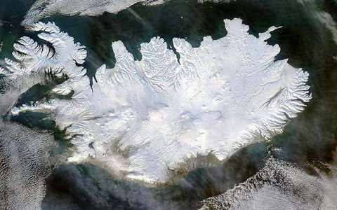 Mid-ocean ridge in the seafloor-spreading lab — a TERMS crop, not the glossary plate and not the lab cover. Divergent plate boundary. Source: Wikimedia Commons / NASA / USGS / public domain.Wikimedia Commons / NASA / USGS / public domain
Vine–Matthews
Magnetic stripes as a tape recorder of reversals and spreading.
 vine matthews in the seafloor-spreading lab — a TERMS crop, not the glossary plate and not the lab cover. A TERMS crop, not the glossary plate and not the lab cover. Source: Wikimedia Commons / NASA / USGS / NOAA, public domain or CC.Wikimedia Commons / NASA / USGS / NOAA, public domain or CC
Oceanic crust
Basalt and gabbro, ~7 km thick, young at ridges, old toward trenches.
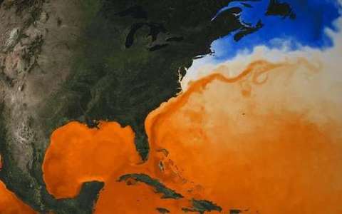 oceanic crust in the seafloor-spreading lab — a TERMS crop, not the glossary plate and not the lab cover. A TERMS crop, not the glossary plate and not the lab cover. Source: Wikimedia Commons / NASA / USGS / NOAA, public domain or CC.Wikimedia Commons / NASA / USGS / NOAA, public domain or CC
Magnetic stripe
A band of normal or reversed polarity, mirrored on both flanks of the ridge.
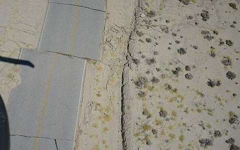 magnetic stripe in the seafloor-spreading lab — a TERMS crop, not the glossary plate and not the lab cover. A TERMS crop, not the glossary plate and not the lab cover. Source: Wikimedia Commons / NASA / USGS / NOAA, public domain or CC.Wikimedia Commons / NASA / USGS / NOAA, public domain or CC
Curie point
Temperature below which cooling rock locks in the ambient magnetic field.
 curie point in the seafloor-spreading lab — a TERMS crop, not the glossary plate and not the lab cover. A TERMS crop, not the glossary plate and not the lab cover. Source: Wikimedia Commons / NASA / USGS / NOAA, public domain or CC.Wikimedia Commons / NASA / USGS / NOAA, public domain or CC
Fracture zone
A scar of transform offset on the ridge. This lab only hints at it.
 fracture zone in the seafloor-spreading lab — a TERMS crop, not the glossary plate and not the lab cover. A TERMS crop, not the glossary plate and not the lab cover. Source: Wikimedia Commons / NASA / USGS / NOAA, public domain or CC.Wikimedia Commons / NASA / USGS / NOAA, public domain or CC