Case study · UK
Snowdonia / Eryri
North Wales
A classroom-perfect contour map: cwms, arêtes, a pyramidal peak, and a railway that cheats the gradient.
Locator · OpenStreetMap / OpenFreeMap · 53.07°, -4.08°
Closed loops around Yr Wyddfa; V-shapes in the cwms. Interval on OS Explorer is 10 m. The same hill in 3D is the point of the contours lab. Spot heights sit on the summit and on the ridges. Tight contours on the east face are a steep drop; wider contours on some western approaches are a gentler slope — until they are not.
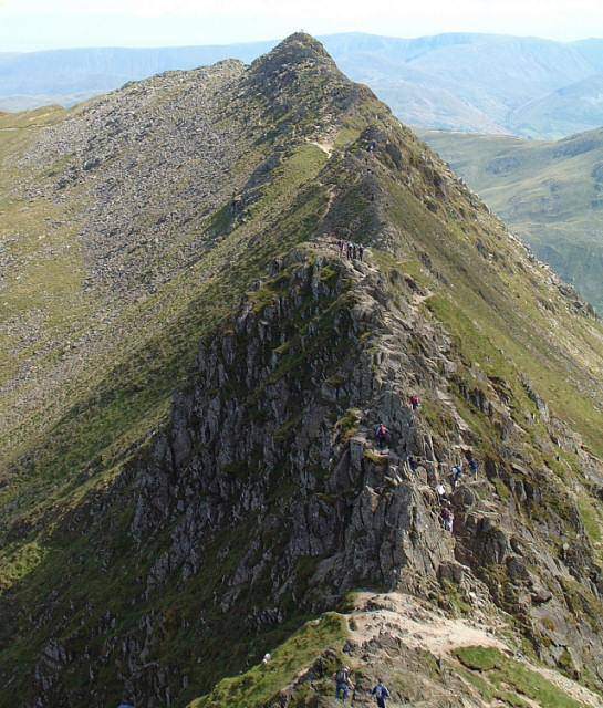
Glacial landforms do the naming. A cirque is a armchair hollow with a steep backwall. An arête is a knife ridge between two cirques. A pyramidal peak is three or more cirques eating a mountain from different sides. Crib Goch is an arête students remember with their hands. Glaslyn and Llyn Llydaw sit in scooped rock.
The railway is a sentence about gradient. A contour skill that can explain why a train hairpins is a skill that will survive the map paper. Grid references on this sheet are the grid-references lab’s natural homework.
Compare Yosemite: a deeper U, granite, hanging valleys, and a rim that reads as coincident contours. Same ice logic, different rock and a different national-park poster.
Exam-style question
On an OS-style extract of Yr Wyddfa, how would you distinguish a cirque from a spur using contours alone?
Teacher hint: Cirque: steep backwall, closed or tight curves around a hollow. Spur: Vs pointing downhill.
Process labs
Sources
- Ordnance Survey
- BGS Wales