Case study · US
Grand Canyon
Arizona
A plateau cut by a river, a stack of sedimentary rocks, and a timeline in metres of cliff.
Locator · OpenStreetMap / OpenFreeMap · 36.05°, -112.14°
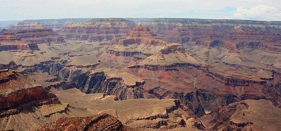
The Grand Canyon is not a rift and not a glacial trough. It is incision: the Colorado River cutting down through the Colorado Plateau as the land was high enough and the river persistent enough. Horizontal beds of sandstone, shale, and limestone make cliffs and slopes according to resistance. The Vishnu Schist at the bottom is metamorphic basement.
The rock-cycle lab’s sedimentary stack is this wall. Weathering opens joints; mass movement delivers; the river exports. The landform is a canyon in a plateau — one of the five types in the landform-types lab, cut rather than built.
Do not invent a date for ‘the canyon formed in X years’ unless you cite USGS. The rocks are Proterozoic to Palaeozoic; the incision is much younger. Students should separate the age of the rock from the age of the hole.
Exam-style question
Distinguish the age of the rocks in the Grand Canyon walls from the age of the canyon as a landform.
Teacher hint: Rocks: hundreds of millions of years. Incision: much younger uplift and downcutting.
Process labs
Sources
- USGS / NPS Grand Canyon